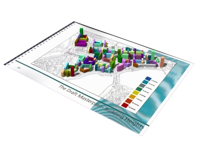
The image above is from a simple test movie developed in the software Sketchup to rapidly visualise proposed heights of buildings. Although developed around the Draft Master Plan for Woodberry Down, it should be noted that this plan was never published and thus the heights are only used for visualisation research purposes. A movie can be viewed from here (5.8mb) as ever it is encoded in DIVX format, which you can find out more about and download the encoder if required from our main movie page.
Sketch Planning Heights
Andy
CASA, UCL East
Recent
The Papers: The 2nd Album
Spatial Computing and the Phygital City: Towards Digital Habitation
Color Weather: A Data Watch Face for the Pebble Time 2
Fenland: A weeWX Dashboard with forecast verification, ensemble models, climate records back to 1940 and finally, that tween...
City Clock: A City where the People Tell the Time