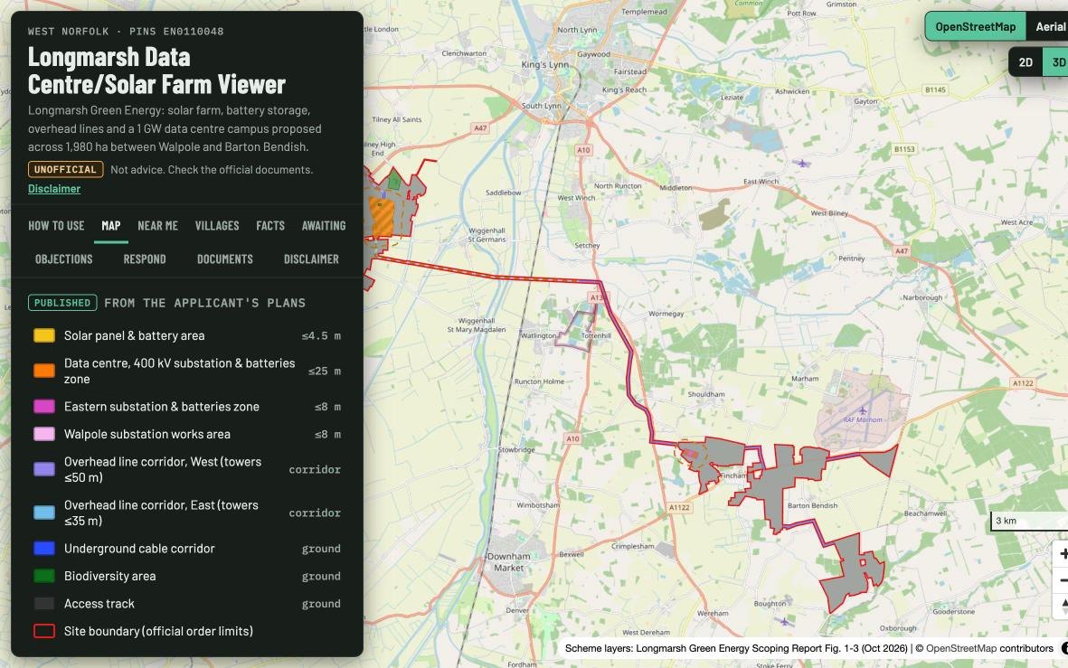
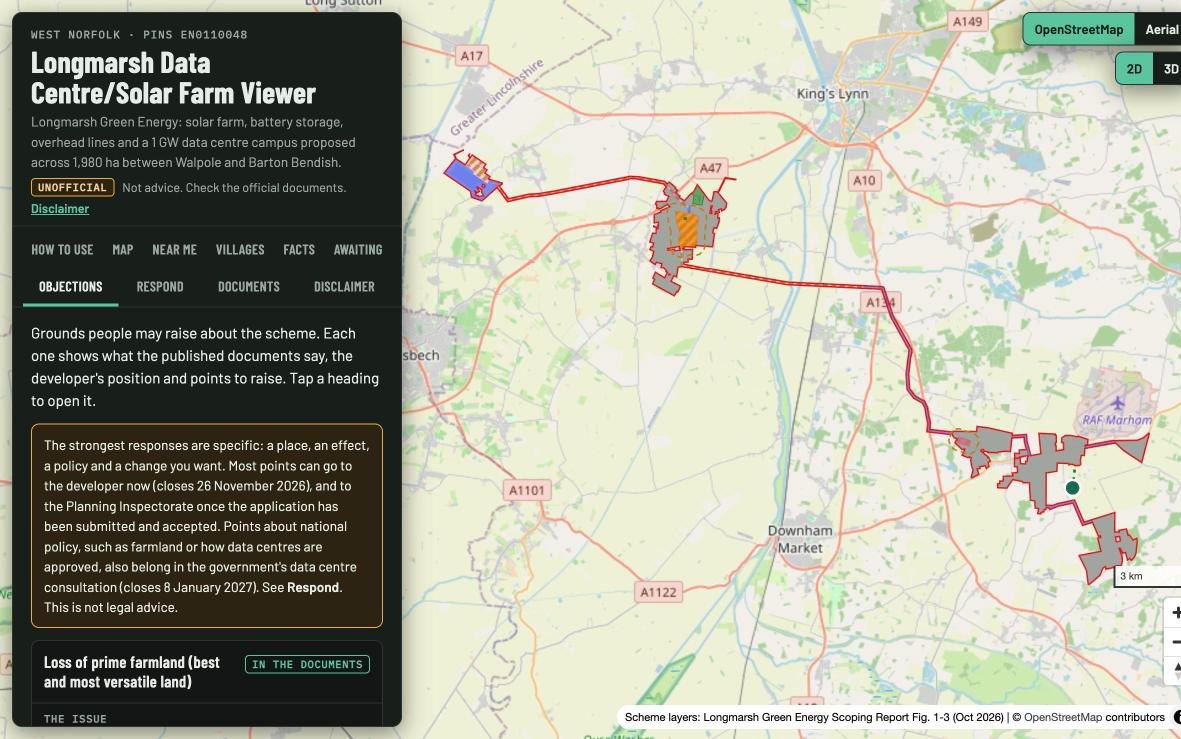
Across west Norfolk, a scheme called Longmarsh Green Energy is now out to consultation. It combines solar panels, battery storage, new overhead lines and a hyperscale data centre campus of around 1 GW, spread across roughly 1,980 hectares of farmland. The site runs for about 29 km, from the National Grid substation at Walpole in the west to Barton Bendish in the east. Its developers describe the solar element as one of the UK's largest solar farms and say it could generate more power than any other currently planned for the UK (BBC, via now.solar).
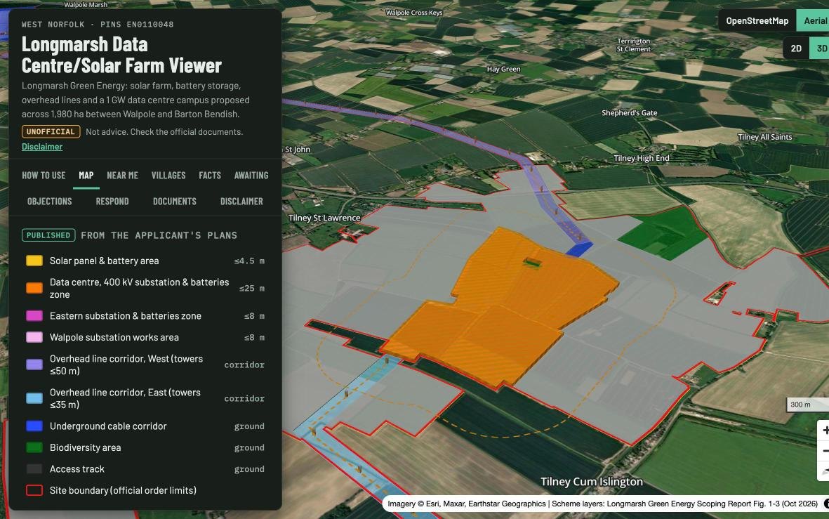
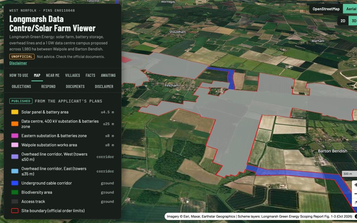
. None of the power however goes into the National Grid, it is purely to power a proposed Data Centre.The proposed solar panels are perhaps unique in their proposal as they wrap entirley around two villages - Fincham, a small village surrounded by farm land and Baton Bendish. The Western Site, where the data centre would go, lies between Tilney St Lawrence, Tilney High End and Tilney cum Islington. The Eastern Site threads between Fincham, Barton Bendish and Shouldham Thorpe. A cable route, part buried and part on new towers of up to 35 m, joins the two. A second overhead line on towers of up to 50 m runs to Walpole.
Prime Farmland, and the Question of Land
Much of the land is predicted to be among the best farmland in England. The developer's own Scoping Report draws on the national predictive land classification map. It shows the Walpole land as all Grade 1, and most of the Western Site as Grade 2 and 3a, with some Grade 1. Planning policy calls Grades 1, 2 and 3a "best and most versatile" land. The government's new draft policy for data centres says poorer land should be used where possible. The developer's position is that around 85% of land within 6.7 km of Walpole substation is of this quality, so there is little alternative close to the grid connection.
It is understood locally that the scheme is made possible by land largely in the hands of a single landowner. The published documents do not yet say who owns the land, so this remains to be clarified. If the developer seeks compulsory purchase powers, the application will have to list every owner and interest. Site selection matters, though. The Scoping Report lists "availability of suitable land" among the reasons the site was chosen, alongside the grid connection at Walpole.
Why Build a Tool
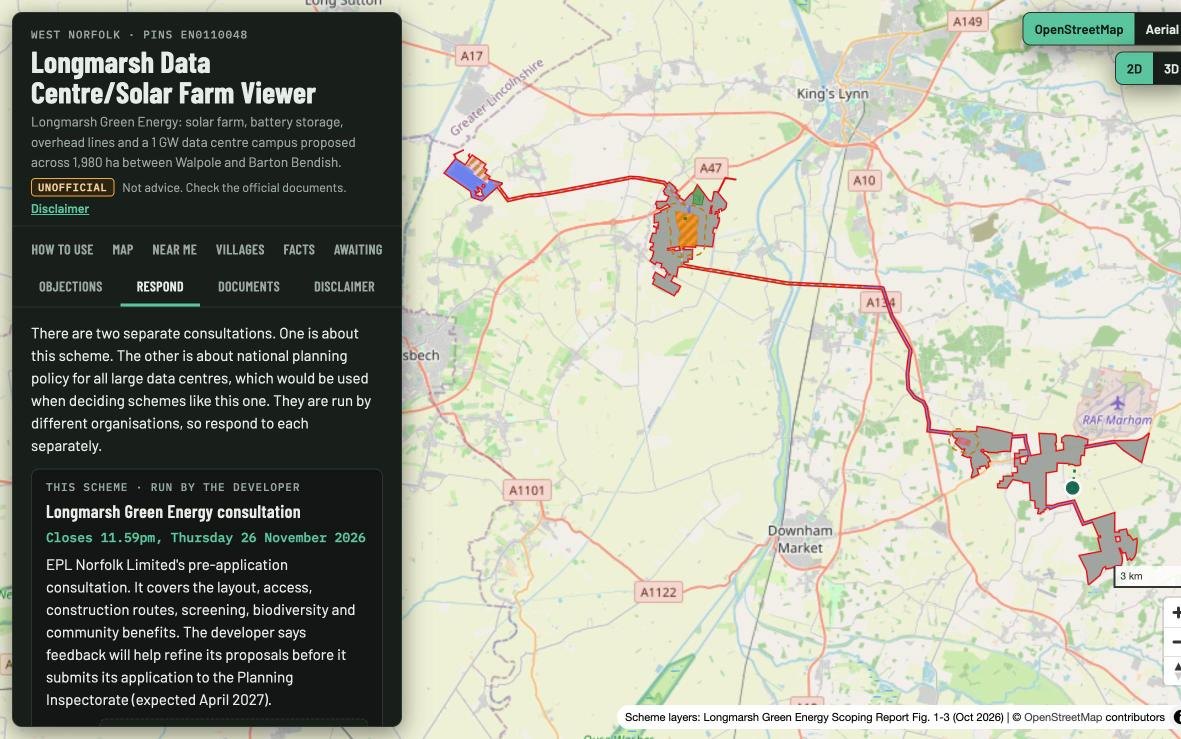
We have been producing maps and data visualisations for over 25 years. In that time the tools have changed beyond recognition, but the core problem in planning consultation has not. The information is there, but it is not legible. The Scoping Report runs to almost 500 pages. The figures arrive as PDFs of 38 and 51 MB. The layout itself is a single drawing, Figure 1-3, that has to be read alongside a key, a set of maximum heights scattered through Chapter 4 and a leaflet with its own maps. Meanwhile, two separate consultations are running: the developer's, on the scheme itself, and the government's, on the draft National Policy Statement for Data Centres that would be used to judge it.
It felt timely to build something that lets the people who live there understand both the scheme and the consultation system. Put the plans on a real map. Let you search your postcode. Show the heights. Separate what has been published from what is still unknown, and point to where and how to respond.
The Viewer
The Longmarsh Data Centre/Solar Farm Viewer is a free, open web map. It runs in any browser and needs no log-in or app. Every layer is labelled either Published, taken directly from the developer's plans, or Awaiting information, a presumption made because the detail has not yet been published. Tap any shape to see its source.
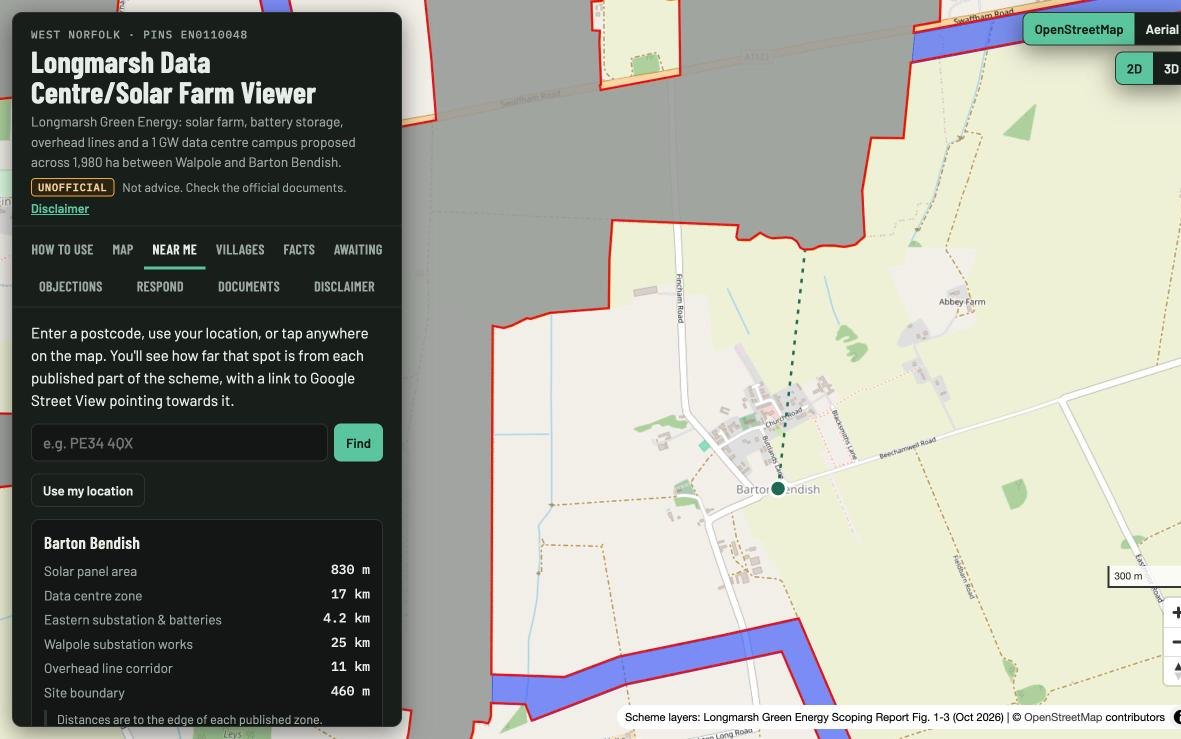
The Near me tab takes a postcode or your location and gives straight-line distances to the nearest solar area, the data centre zone, the substations and the overhead line. From there you can open Google Street View pointing towards the nearest part of the scheme, to compare today's view with what is proposed. The Villages tab does the same for 45 surrounding villages, sorted by distance.
The remaining tabs cover the consultation. Facts has the key figures, maximum heights, design commitments and timeline. Awaiting lists what has not yet been published. Objections sets out the issues people may raise: farmland, flood risk, the 50 m towers, heritage settings, the heronry SSSI inside the site boundary, traffic, noise and lighting. Each issue gives what the documents say, the developer's own position and the paragraph references. Respond gives the deadlines and the postal and email addresses for both consultations.
How it Was Made
The layout plan in the Scoping Report is a vector PDF, so the solar areas, data centre zone, substations, cable corridors and boundary could be lifted directly from the drawing. To place them on the ground, we used the Ordnance Survey grid printed faintly on the figures' base maps. Detecting those 1 km grid lines (rotated by 1° on the page) gives an exact link between the drawing and British National Grid coordinates. Checked against the official boundary file published by the Planning Inspectorate, the traced outline agrees to a median of about 4 m. On aerial imagery it follows field edges and wraps the existing Walpole substation as it should.
Have Your Say
The developer's consultation closes at 11.59pm on 26 November 2026, by Freepost LONGMARSH GREEN ENERGY, email or the online form. The government's consultation on the draft National Policy Statement for Data Centres closes at 11.59pm on 8 January 2027. The Planning Inspectorate will take formal comments once the application, expected in April 2027, has been submitted and accepted. Full details are in the viewer's Respond tab.
The viewer is independent and unofficial. It is based on documents published in October 2026, early in the consultation, and the scheme will change. Please check anything important against the original documents, which are all linked from the viewer, and see its Disclaimer tab.