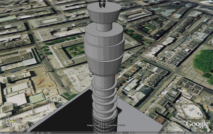
Google Earth has added 25cm imagery of London from the GeoInformation Group. This provides a much improved backdrop to models such as the BT Tower which we have now placed online.
Thanks go out to the comments and emails with reference the black roof and reversed faces. These are now fixed and the file size has also been reduced from 746K to 540K.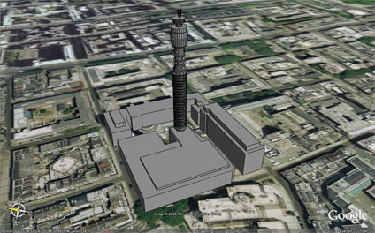
Larger sections of London should be available shortly.
You can download the kmz file to fly into the model in Google Earth here (540k)
Google Earth BT Tower London
Andy
CASA, UCL East
Recent
The Papers: The 2nd Album
Spatial Computing and the Phygital City: Towards Digital Habitation
Color Weather: A Data Watch Face for the Pebble Time 2
Fenland: A weeWX Dashboard with forecast verification, ensemble models, climate records back to 1940 and finally, that tween...
City Clock: A City where the People Tell the Time