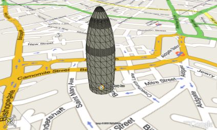
A rapid model of 30 St Mary Axe in London with Google Maps overlayed in Google Earth. The air photography of London is low resolution at the current moment, thus the need to overlay the streets with imagery from Google Maps. The map placement is approx 5 metres out but it illustrates a good proof of concept. Google Earth is also rendering the edge profile the building, this should be sorted in a few days.
Thanks go to the overlay creator at Google Map Overlays
You can download the kmz file to fly into the model in Google Earth here (56k)
Google Earth Model and Map Overlay
Andy
CASA, UCL East
Recent
The Papers: The 2nd Album
Spatial Computing and the Phygital City: Towards Digital Habitation
Color Weather: A Data Watch Face for the Pebble Time 2
Fenland: A weeWX Dashboard with forecast verification, ensemble models, climate records back to 1940 and finally, that tween...
City Clock: A City where the People Tell the Time