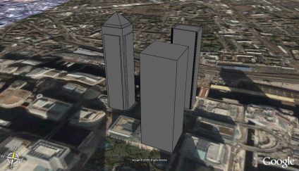
Modelled along the lines of the 30 St Mary Axe post in this blog are three buildings in Canary Wharf. The map overlay is currently imprecise, perhaps showing an error in the accuracy of Google Maps as the buildings load up in the dock with the Google Map view on.
You can download the kmz file to fly into the model in Google Earth here (50k)
Google Earth Canary Wharf
Andy
CASA, UCL East
Recent
The Papers: The 2nd Album
Spatial Computing and the Phygital City: Towards Digital Habitation
Color Weather: A Data Watch Face for the Pebble Time 2
Fenland: A weeWX Dashboard with forecast verification, ensemble models, climate records back to 1940 and finally, that tween...
City Clock: A City where the People Tell the Time